- (770) 759 0786
Aerial 3D Rendering for Real Estate in Texas: Transforming Property Visualization
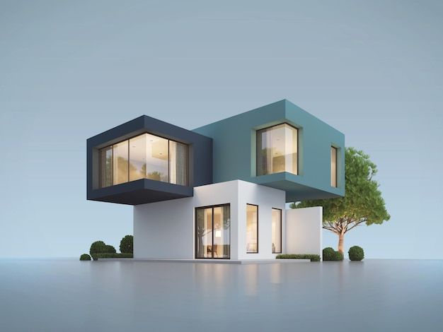
3D Aerial rendering gives Texas real estate professionals the ability to display properties with unparalleled clarity. You can display entire communities, landscapes, and developments before they are constructed.
From industrial rendering to commercial rendering, this tech has become important in the real estate marketing sector. In this blog, you will know about 3D aerial rendering, Different techniques used in Aerial visualization, Costs, Benefits of this service and much more.
What 3D Aerial Rendering Is for Real Estate
3D aerial rendering is gaining the ability to create realistic images of a scene of buildings, streets, and the vicinity of a place that has not yet been built, from up high.
This technology is valuable for real estate designers. They can use aerial drones, GIS maps, and 3D geo modeling to focus and pinpoint key developments in their project.
For developers and even real estate agents, this technology is a show-and-tell tool designed to win over a customer or a client, and that has been the vision for several years.
This tech combines the worlds of architecture with the world of visualization and gives the potential of completing the vision to see how a property works with its environment. Perfect for the large, commercially designed places, it is possible to show both the scale and the beauty of the property.
Different Techniques Used in Aerial Visualization
In the modern age of advertising for the real estate market, several marketing disciplines for Visualization have aged. Every technology serves different purposes and objectives for the specific stage of each project.
1. Aerial Renderings
Ideal for large-scale developments, resorts, and large community layouts. With a single snapshot, they feature landscapes, access roads, and adjacent amenities.
2. 3D Walk-Throughs
An engaging and interactive technique. They let buyers check out the rooms, hallways, and even the outdoor spaces, all virtually. You can showcase the designs and finishes set before the construction even starts.
3. CGI Panoramas
They make immersive CGI panoramas for a powerful visual experience. Viewers can spin the scene and obtain the complete spatial perspective. These are ideal for marketing high-rise projects and luxury developments.
4. Integrated Drone Views
Real aerial footage and digitally created product combined produce a realistic outcome. This is used to show how the landscape that presently exists will merge with the structures that will be built. It creates a seamless border between reality and the concept.
5. Virtual Staging
Use aerial views combined with digitally created interiors. Show outdoor terraces and gardens landscaped and furnished before real construction is complete.
These techniques enable real estate professionals to present their ideas in an engaging and articulated manner.
3D Aerial Rendering Services in Texas
You can find professional studios in Marched Texas cities such as Austin, Dallas, and Houston. Local companies are prevalent in making visuals for documentation in construction and real estate marketing.
When choosing a studio, the following should be taken into consideration:
- Knowledge in zoning and landscape modeling in Texas.
- A strong architectural background with detail-oriented work.
- A portfolio containing 3D aerial renders for real projects.
- Quick turnaround and revision support.
Top Texas companies tend to offer full-service packages with animation, drone imaging, and marketing visuals. Many provide online consultations with project size and scope, customized pricing.
If you need frequent rendering support, subscription or retainer options provide excellent value. These are best for developers who are overseeing multiple listings or phases.
How Much Do 3D Aerial Renderings Cost in Texas?
Costs vary by complexity, size and turnaround time. On average, a single 3D rendering in Texas ranges from $300 to $1,500. Aerial shots with landscaping and lighting effects cost more, around $1,500 to $3,000 per image.
Factors influencing price include:
- Level of architectural detail.
- Number of renders or camera angles.
- The need for drone data or custom CGI.
- Your delivery date.
Residential projects are more affordable. As the scope of work increases, so do requirements, and therefore, projects tied to large industrial or mixed-use developments become more expensive. Most companies will provide estimates after discussing design files and objectives.
Benefits for Real Estate Professionals
Using aerial visualization will improve your marketing results. Here’s how Texas real estate agents benefit:
1. Great First Impressions
Great images help real estate advertisements pop. Buyers trust images that are clear and well displayed.
2. Selling Speed
Great details help buyers visualize the entire project and gain the confidence to buy early.
3. Avoid Adding Last-Minute Changes
Many developers and architects focus on identifying design flaws before building. This saves everyone time and money.
4. Selling to Clients Who are Far Away
Buyers who are out of state don’t have to travel to see the property. This allows you to expand your business to places that are far away.
5. Flexible Marketing
You can use the same design for different marketing materials, like websites, social media, presentations and brochures.
6. Better Communication with Clients
Clear images and descriptions help clients, developers, and investors understand the project better. This avoids any frustration and delays approvals.
Having aerial images greatly increases the chance of making a sale in Texas.
Successful Projects in Texas Using Aerial 3D Renderings
Many Texas projects have used marketing visualization to gain buyers ‘ attention.
- Austin Downtown Mixed-Use Tower: Used aerial marketing images to sell office space and luxury condos.
- Dallas Residential Community: CGI panoramas on the master planned neighborhood helped sell 40% of the homes before construction.
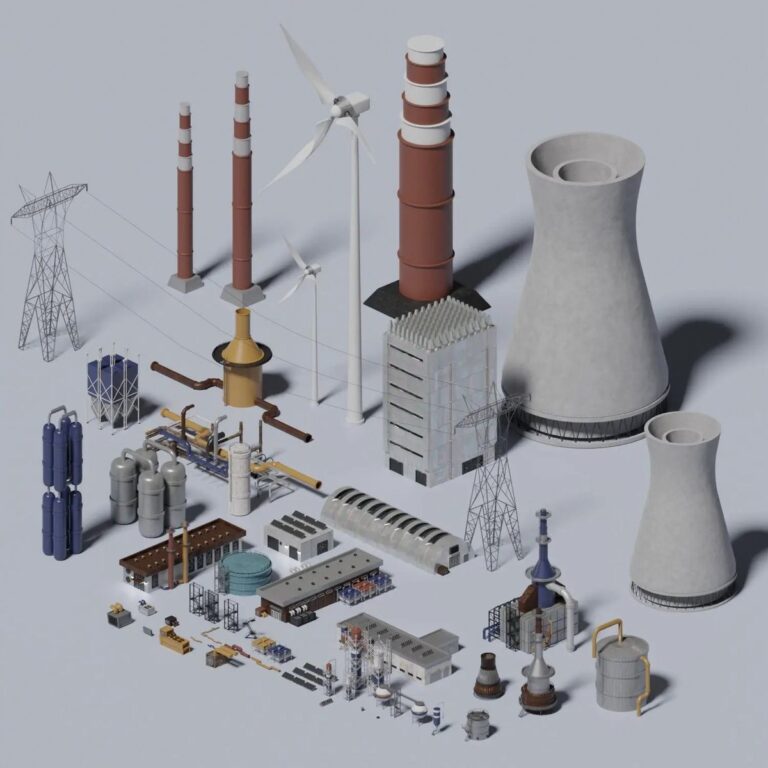
- Houston Industrial Park: For an industrial rendering, they illustrated the logistics routes and warehouse spacing for the prospective investors.
- San Antonio Resort Development: they used 3D walkthroughs to help prospective buyers secure early bookings for vacation villas.
Sales and investor confidence truly are a result of good visualization, as seen in these projects. In real estate, we get to see a space as a whole using aerial imagery.
Conclusion
3D Aerial rendering in Texas has become an important component in the marketing of real estate. You are able to display entire properties, lines, and even whole communities before they are created. This process brings clarity, speed, and character to your selling system.
The right rendering partner will transform your ideas into powerful visuals that will dramatically elevate your selling system. For Texas developers, it’s not just marketing—it’s a competitive advantage.
FAQ'S
What is 3D aerial rendering?
3D aerial rendering captures an elevated view of the property. This visualization is important because it shows the layout and surrounding structures, which are important to potential buyers, thus its importance to marketing the property.
How much does a 3D aerial render cost in Texas?
In Texas, costs for 3D aerial renders range from USD 1,000 to 3,000. This depends on the size and complexity of the project, the level of detail the client is asking for, and the amount of time they want.
Why use commercial rendering for real estate projects?
Before construction, commercial rendering allows you to visualize office, retail, and mixed-use buildings. You can highlight the quality of your design, capture the interest of customers, and significantly increase your marketing engagement.
What makes industrial rendering valuable for developers?
With industrial rendering, you can foresee your warehouses, logistics hubs, and factories even before building them. It makes planning and designing, and attracting industrial investors easier.
Where can I find 3D rendering services in Texas?
There are 3D rendering businesses in Austin, Dallas, and Houston. These professionals provide Texas architects, developers, and real estate professionals with renders and other visualizations.